Steps: 2,728,225
Miles: 1140.95

The Chesapeake Bay Bridge-Tunnel (CBBT) is a 23 mile long facility that connects the Delmarva Peninsula with southeastern Virginia. It crosses the mouth of the Chesapeake Bay. It will take the Virtual Walker three days to cross it.
The bridge-tunnel uses a combination of bridges and tunnels over and under two widely separated shipping channels, using four artificial islands built in the bay as portals. The CBBT provides the only direct link between Virginia's Eastern Shore and Hampton Roads region.

Sea Gull Island is located on the southernmost of the Bridge-Tunnel's four manmade islands, 3-1/2 miles from Virginia Beach. This island provides the traveling public an opportunity to stop, stretch their legs, grab a bite to eat, cast a line off the fishing pier, birdwatch, or just take in the natural beauty and sounds of the Chesapeake Bay.

The bridge-tunnel opened on April 15, 1964, replacing a fleet of ferry boats and was considered "One of the Seven Engineering Wonders of the Modern World" at the time.
On July 1, 1964, many of the surplus ferryboats were utilized to begin the Cape May-Lewes Ferry, a service which carries U.S. Highway 9 across the Delaware Bay between Cape May, New Jersey and Lewes, Delaware. The Virtual Walker will "walk" across the mouth of the Delaware Bay on one of these ferry boats, so more on them later.

Even back then, I took pictures of *them*
If you recall the entry I made concerning Kitty Hawk, Kill Devil Hills and the Wright Brothers, I told of the many trips to the Outer Banks and the Cape Hatteras area, we got there by going over the CBBT - it was one of the big highlights of the trip there and back!


8 comments:
LOL...yep, even back then.
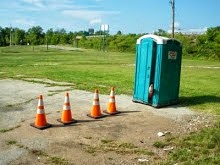
Cool pics. I've never been down that way, but it sure looks like a cool place to drive thru. I would probably go a little bit crazy in the tunnels tho. (get me outta here!) Does the Island also have a potty break place to visit, too? LOL
Im with Alice...those tunnel sections would drive me positively mad (not that Im not mad in a way now anyhow without the tunnel...). I have trouble going through the one that's near hubby's hometown...it goes through a mountain...I hate the damn thing.
The tunnels are well lit, and much like the ones on the PA turnpike. The one tunnel has rest area at one end (the Seagull Pier) otherwise, its 23 miles of highway without much of a shoulder.
I can't imagine actually *walking* across this bridge but there is a once a year, "walk the bridge" event - I'll pass on that one.
I think it would be cool to see. But I'm with you, I think I'll pass on the walk across...
Not sure I would want to be driving under water. Through a mountain is one thing, but under water?
I like the reflection in the first picture of the person who took it. It shows the railing off the bridge, or wherever that sign is, too.
I didn't even notice that reflection, chicagolady, so I went back to the pic and now I see it.
Whew. No one noticed the "birdie poop" under the compass rose. I was going to wipe it off, but had nothing handy.
The sign is outside the restaurant on Seagull Island.
Post a Comment