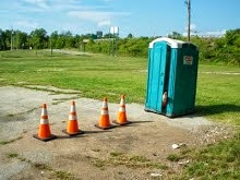
Thursday, January 31, 2008

Mile 448 - Faver-Dykes State Park

As of January 31, 2008 at 8:15 AM
Steps: 1,054,144
Miles: 448.83

Noted for its pristine condition, Faver-Dykes State Park borders Pellicer Creek as it winds along Florida's east coast highways down to the Matanzas River. Pellicer Creek is a popular site for birding with more than one hundred bird species seen during spring and fall migrations. Songbirds, including the colorful wood warblers, along with eagles and falcons, return to nest at the park each year. Wading birds, such as egrets, wood storks, white ibis, and herons, feed in the tidal marshes and creeks. This peaceful park is also home to deer, turkeys, hawks, bobcats, and river otters.


Truely awesome picture titled "Water Flamingo" by Robert Keating

Photo Source

Wednesday, January 30, 2008

An Intense Alien

As of January 30, 2008 at 9:10 AM
Steps: 1,036,705
Miles: 441.40

The Virtual Walker is being hampered by a cold.


Please inspect the artwork of an Intense Alien.


I don't know what these most particular markings mean, other than they suggest the poor alien went insane or perhaps he/she had a cold and drank too much Nyquil.

Tuesday, January 29, 2008

A Major Holiday Coming Up!

For all you "Sick of Winter" types!! Mark your calendars for February 2!


In 1723, the Delaware Indians settled Punxsutawney, Pennsylvania as a campsite halfway between the Allegheny and the Susquehanna Rivers. The town is 90 miles northeast of Pittsburgh.

The Delawares considered groundhogs honorable ancestors. According to the original creation beliefs of the Delaware Indians, their forebears began life as animals in "Mother Earth" and emerged centuries later to hunt and live as men.

The name Punxsutawney comes from the Indian name for the location "ponksad-uteney" which means "the town of the sandflies." The name woodchuck comes from the Indian legend of "Wojak, the groundhog" considered by them to be their ancestral grandfather.

When German settlers arrived in the 1700s, they brought a tradition known as Candlemas Day, which has an early origin in the pagan celebration of Imbolc. It came at the mid-point between the Winter Solstice and the Spring Equinox. Superstition held that if the weather was fair, the second half of Winter would be stormy and cold. For the early Christians in Europe, it was the custom on Candlemas Day for clergy to bless candles and distribute them to the people in the dark of Winter. A lighted candle was placed in each window of the home. The day's weather continued to be important. If the sun came out February 2, halfway between Winter and Spring, it meant six more weeks of wintry weather.

The earliest American reference to Groundhog Day can be found at the Pennsylvania Dutch Folklore Center at Franklin and Marshall College dated February 4, 1841.

History Source

Official Punxsutawney Phil Site - Note the message about the long lines for the shuttle bus at 3:00 AM!

P.S., Pray for clouds. "If he sees his shadow, be prepared for six more weeks of winter weather. If there is no shadow to be found, then spring is just around the corner!"

Monday, January 28, 2008

Mile 434 - Flaglers Beach

As of January 28, 2008 at 7:35 PM
Steps: 1,017,668
Miles: 433.30

About 30 miles south of the City of Saint Augustine, Florida, a place where our Railroad Tycoon, Henry Morrison Flagler had great impact, is the town of Flagler Beach. Flagler Beach was originally named "Ocean City Beach," and was renamed in 1925 after Henry Flagler passed away.


This photo was taken from the top of the Flagler Hotel which was located on the current Farmers Market land.

Photo Source


Busy day at the beach - Parking is no problem.

Photo Source

"The Peaceful Beach: It's the land that time forgot. Flagler Beach is often called the "Peaceful Beach" because of the lack of interest from the outside world. The coastal highway hugs the shore here and Flagler Beach is but steps away, yet it seems to be the most undiscovered coastal locales. Thriving in the 1920s, Flagler Beach died during the depression and not many advances have been made since then. Much of the area appears unchanged since the 1950s giving it a kind of off-the-beaten-path charm.

...The Flagler Beach Pier juts into the Atlantic where fishermen cast their lines. The break by the pier makes for some of the best surfing in the area, especially after a storm.

The six miles of sand is marked by numerous private dune crossovers that drop rather sharply to the narrow beach below a short bluff. The sand is often a ruddy orange colored by coquina which comes from an offshore formation."

Source


Charles Lindbergh of first to fly solo over the Atlantic Ocean fame.

On Saturday, November 28, 1931 Colonel Charles Lindbergh left Miami before daylight in a borrowed U.S. Army airplane on a flight to New York. He had just completed the first voyage of the Pan American Airways American Clipper between Miami and Barranquilla, Colombia. While flying over Flagler Beach Lindbergh noticed the airfield and about fifteen miles north of town he encountered dense fog. Colonel Lindbergh turned around and landed on the grass runway at the Flagler Beach Municipal Airport at about 9:15 a.m.

Photo and History Source

Charles Lindbergh ended up staying for a week at the Flagler Beach Hotel. He visited again in 1934. Additionally, Admiral Byrd (1932) and Amelia Earheart (1936) landed at the Flagler Beach Airport.

Sunday, January 27, 2008

Oh my gosh! I'm excited!

I took my walk today in what I thought was the Real World but after seeing what I saw, I'm not totally sure about that!

Abandoned Alien Spaceships?!?!?! These spheres are about ten feet in diameter.


The hatch is blown wide open. Did the Aliens inside survive the Earth's polluted atmosphere? Are the Air Force chaps coming to haul these "things" off to Area 51? Will we ever know just what these things really are?

Another site's pictures - but no information on what the spheres are.

Will I reach a million steps today?

As of January 27, 2008 at 5:30 PM
Steps: 999,582
Miles: 425.59

Saturday, January 26, 2008

Scientists Discover New Aliens


Today, scientists announced a previously unknown species of aliens were discovered near an Acme Supermarket. Christened, Cement-Headed Door Watchers these aliens have been observed to behave in strange ways.


All known Cement-Headed Door Watchers are believed to be outside looking at a door. Do they want in? Are they cold? What do they want? How intelligent are they (I mean, gee... their heads are filled with cement-like substance)? Are they always yellow? Is what appears to be rust, really blood? body waste? Tears of frustration?

Interpreters are wanted. If you think you can mind-meld or somehow "speak" to members of this newly discovered species... We want to know.

Mile 411 - Daytona Beach

As of January 26, 2008 at 8:25 AM
Steps: 965,029
Miles: 410.87

July 1, 2005 to January 26, 2008 at 8:25 AM
Steps: 15,015,618
Miles: 6,471.22


Sunday, February 17, 2008 will be the 50th Running of the DAYTONA 500

Daytona International Speedway opened in 1959, but the history of auto racing at Daytona goes back much farther than that.

In 1936, the precursor to today's Daytona 500 was born on a course that went down 1.5 miles of highway, then turned and came the same distance back up the beach.

William H.G. France, a mechanic and racer who'd moved south from Washington, D.C., eventually took over the job of running the beach races on the second of two courses used for those events. In 1947, he presided over a meeting at Daytona's Streamline Hotel where NASCAR was born.

"Big Bill" France insisted on 31-degree banking in the corners on his new track. That's as steep as he could make the turns and still keep the machines putting down the asphalt from tipping over.

When drivers gathered for the first Daytona 500, it was an eye-popping experience. Drivers were more accustomed to half-mile dirt tracks and saw the 1.366-mile paved track at Darlington as vast. A trip around Daytona International Speedway was 2.5 miles -- nearly twice that.

Bob Welborn ran 140.121 mph to win the pole for the first Daytona 500, and Lee Petty won in a photo finish over Johnny Beauchamp.

It was at Daytona International Speedway where Junior Johnson discovered that if he tucked his car right behind another one, he could go faster than he could run by himself. And drafting became a part of the sport.

It was also at Daytona where Cale Yarborough topped 200 mph on his first qualifying lap in 1983 and then, as he went even faster on a second lap, his car took off and flew, turning upside down before crashing.

Bill Elliott set the Daytona track record in 1987, running 210.364 mph, just before restrictor plates were introduced to the sport.

The Daytona 500, considered NASCAR's biggest event, has hosted some of NASCAR's greatest moments -- and maybe its greatest tragedy.

Many considered the 1976 Daytona 500 as the greatest race of all time.

Richard Petty won seven Daytona 500s on his way to becoming "The King," but lost in '76 to rival David Pearson after they wrecked coming to the finish line and Pearson puttered across the stripe bumping his car along with his ignition.

In 1998, in his 20th try, seven-time Cup Series champion Dale Earnhardt finally won the Daytona 500. Sadly, three years later, Earnhardt died in a Turn 4 crash in the 2001 running. It was a moment that changed the sport forever.

History Source


The Virtual Walker's kind of Beach


The Real World Beach

Friday, January 25, 2008

Under the Weather

As of January 25, 2008 at 10:15 AM
Steps: 948,992
Miles: 403.92

July 1, 2005 to January 25, 2008 at 10:15 AM
Steps: 14,999,581
Miles: 6464.27

A couple million steps milestones coming up soon.

Thursday, January 24, 2008

Sanford - The Celery Capital of the World


As of January 24, 2008 at 7:58 AM
Steps: 929,668
Miles: 395.81


Sanford? What is in Sanford, Florida that would interest anyone? Well, as the Virtual Walker will say, "If you look hard enough, there is always something to look at."

Sanford was named after its founder, Henry S. Sanford, 1823-1891, who was a lawyer, diplomat, and innovator in the production of citrus. Ah, more Florida Oranges.

The picture shows Monroe Harbour which is located at the very end of the Saint John's River in Sanford. You can go down (north) this beautiful river to Jacksonville, and then out into the Atlantic Ocean.


Sanford is also the home of the Central Florida Zoo and this Crocodile.

Crocodile Photo Source


But for the Virtual Walker, the most interesting thing in town is located at 600 South Persimmon Avenue, the terminal for Amtrak's Auto Train!

This train runs from Lorton, VA (just south of Washington D.C.) non-stop (sort of) to Sanford, Florida and back carrying people and their cars. People bound for Disney Land, The Florida Keys, and other places in sunny Florida and home again.

Amtrak loads your car into an Autorack and you into a sleeper coach - where you can relax, eat and sleep, while Amtrak does the driving.


Sparkling Clean Sleeping Car


Shiny Amtrak Engine


Not-so-shiny Autorack


Drive-in, Amtrak Style


Of course, like lots of other fun trains, this one has some assembly required.

Amtrak Photo Source

Wednesday, January 23, 2008

They're not just for breakfast anymore...

As of January 23, 2008 at 7:45 AM
Steps: 912,117
Miles: 388.34

Please note: I did not write any of this material, it was abstracted from the sources noted.


The origin of the modern traffic cone is a mystery that has perplexed researchers for decades. There are few similarities between Orange Coneheads (Orangus Conus) and any other species living today, leading scientists to believe that it diverged from from the evolutionary tree quite early. Its flat foot, distinctive cone-shaped body, and lack of appendages evolved for reasons not entirely known.

Source


Cone Friend

One day while jogging down the street,
I stopped to rest my weary feet,
Beneath a tree I saw a sight,
That filled my heart with joy and light,
A cone! A beautiful cone stood tall,
Waiting for me to call,
And lead him to our little home,
And stay with us and never roam,
Our hearts have been happy, our spirits always soar,
Ever since that little angel came through our door.

Source


Orange Coneheads are not picky creatures, and most can live in a wide range of habitats. However, there are a few simple things that can make your pet cone feel more at home. As cones are naturally territorial, it is recommended that you set apart a small corner of your house or apartment that they can call their own. You might adorn this "cone home" with a photograph of a construction site or a bit of yellow caution tape. A small slab of asphalt or concrete for resting upon may also be greatly appreciated.

Cones need very little in the way of maintenance. Periodically, they should be wiped down with a clean, damp cloth.

Cones can be obtained from all good hardware stores. They can also be obtained through the Traffic Cone Preservation Society's Cone Adoption Program. It is not recommended that you obtain cones from the wild. Many species are endangered, and removing them from their natural habitats and duties could threaten their survival.

When choosing a cone, make sure it has a healthy shiny coat, sturdy foot, and a curious nature. Research to see what type of cone would best suit your needs. Some cones grow quite large, and would not be suitable for apartment living.

Source

Of course, like any other pet, Coneheads eventually pass on to another place.


In Loving Memory of Bubba - 1987-1996


My family never considered adopting a cone until we met Bubba. We were in the hardware store looking for a nail gun when something bright caught our eye. There Bubba was- a shining orange bundle of joy just waiting for a loving home. Instantly, nails were forgotten, and the charming orange cone came home instead. There were few things more delightful than seeing Bubba waiting in the window for us to come home, or protecting the children from minor household threats. Bubba might have grown less vibrant orange with age, but he kept his blithe and spunky spirit until the end. We will miss Bubba, he was a great friend and loyal companion to us all.

Source

Tuesday, January 22, 2008

Canaveral National Seashore


The Virtual Walker would willingly pay the park usage fee*

* - with virtual money of course.

As of January 22, 2008 at 9:05 AM
Steps: 893,666
Miles: 380.35


Canaveral National Seashore is on a barrier island which includes ocean, beach, dune, hammock, lagoon, salt marsh, and pine flatland habitats.

The barrier island and adjacent waterways offer a blend of plant and animal life.

Records show that 1,045 species of plants and 310 species of birds can be found in the park. Endangered species include, but are not limited to, loggerhead, green and leatherback sea turtles, West Indian Manatee, Southern bald eagle, wood stork, peregrine falcon, eastern indigo snake, and Florida scrub jay.

I'd walk on either the side of the road in the first picture or on the beach any day.


An endangered Southern Bald Eagle


Run! Little Sanderling Run!

Source of Bird Pictures - David Faintich


Ahhh... Warm Water over Multicolored Coral - Blade Fire Coral and Orange Sieve Encrusting Sponge, with Yellowhead Wrasses.

There is no reward like floating weightless in warm water after a long day's walk.


Exotic Colors and Fishes - Honeycomb Cowfish (Acanthostracion polygonia) with Elkhorn Coral (Acropora palmata) and a Dusky Damselfish (Pomacentrus fuscus.)

Can you say Acanthostracion polygonia?

Patrick Lynch has quite an eye when it comes to taking pictures. I highly recommend his website if you want to see more pictures.

Source of Reef Pictures - Patrick Lynch

Next stop Daytona Beach!

Monday, January 21, 2008

Jay Jay, is it a Plane? is it a Bird?

Mile 376 - Jay Jay, Florida

Due to the cold weather and to having something to do this weekend, the walker didn't get very far down the road on Sunday... So I won't post an update on the steps and miles today.


Near Cape Canaveral, Florida is a the town called "Jay Jay."

Looking into it a bit more, I find that it is 38F (and unusually cold) there whereas it is 18F in the Real World. They do expect it to get to 58F there later on today, however.

I also find that Jay Jay is located in Brevard County at latitude 28.646 and longitude -80.82. The elevation is whooping 3 feet. The town is also in the Eastern time zone.

I also found that there is a Jay, Florida out in the western panhandle near Pensacola which is can be confused with Jay Jay.

...but what I want to know is ...from where did the town get its name?

But there is no joy in Mudville - mighty Googler has struck out.


I can only guess Brenda Blue lives there, or perhaps the town was named after the call of the Scrub Jay.

The bird photograph from Marie Read - Highly Recommended!

To commemorate today:
I Have a Dream by Martin Luther King Jr - August 28th 1963

Sunday, January 20, 2008

10-9-8-7-6-5-4-3-2-1 We Have Liftoff!!!

As of January 20, 2008 at 5:00 PM
Steps: 874,508
Miles: 372.32


A View of Cape Canaveral - and the John F. Kennedy Space Center.

If you click on the picture you will see more clearly a red dotted line showing the separation between NASA and the Air Force facilities. At the left top, you see the runway used to land the Space Shuttle. The upper right is Launch Pad 39, where the missions to the moon were launched. The Vehicle Assembly Building (VAB in NASA-speak) is shown at the end of a roadway used to move the assembled rockets from the building to the launch pad.

The Cape Canaveral Lighthouse is in the lower far right. The Mercury and Gemini missions were launched in the Air Force area in the middle to middle right. The nuclear submarine missiles were tested from the area near the bottom.


Here we see a Delta rocket being launched. Both NASA and the Air Force have launched a number of sattelites that have changed our world considerably. Clicking on this picture brings out a whole world of details and NASCAR-like decals!


Here we see Apollo 15 leaving Launch Pad 39 on a tail of red flame. Ever since I was a wee lad, I've always been impressed by the sheer magnitude of smoke and flame these rockets generated. Clicking on this picture will fill your screen with smoke and flame without setting off your smoke alarm.


Here we see a Space Shuttle leaving the pad. Ever since the disaster on Tuesday, January 28, 1986, when the Space Shuttle Challenger exploded only 73 seconds after lift-off, I have not been able to bring myself to watch anymore rocket launches. Clicking on this picture however, will show you that the Space Shuttle is no slouch when it comes to spitting flame, smoke and fury.


Every splashdown was a thrill beyond words for me... ...and each safe landing is something for which I am thankful.

Saturday, January 19, 2008

Houston, we've got a problem


As of January 19, 2008 at 7:30 AM
Steps: 852,342
Miles: 362.88

In the beginning Cape Canaveral was without name....

Since this is a long entry, I'll save the pictures for next time.

Although maps containing the rough geographic boundaries of Cape Canaveral, albeit without a name, are dated as early as 1502, Spanish explorer Ponce de Leon has been credited with first exploring the region in 1513. His second landing in Florida was just south of Cape Canaveral, probably near the present day town of Melbourne Beach.

Ponce de Leon was forced to retreat hastily from the area after being attacked by fierce inhabitants, probably the Ais "indians." He did, however, have time to secure water and food, but no information on the famed "Fountain of Youth" treasure for which he was looking.

The oldest known map containing the name Cape Canaveral was made in 1564, well after the initial landing by Ponce de Leon. While the reason behind the name is unknown, it is of Spanish origin.

The name "Cape" is Spanish for a point of land jutting out into the sea. "Canaveral", literally translated is "canebrake", thus Cape Canaveral has been roughly translated as "Point of Reeds" or "Point of Canes".

So it was... Cape Canaveral.

Cape Canaveral, along with the rest of Florida, became a possession of the United States as a result of the Revolutionary War. In fact, the last naval battle of the Revolutionary War was fought about 72 miles southeast of Cape Canaveral.

On March 10, 1783 the British ship HMS Sybil challenged the French-built ship Duc de Lausun and the American ship Alliance. The British ship, as well as three others which gave chase later, were successfully outgunned and driven off by the Alliance.

In 1843, the U.S. government selected Cape Canaveral as the site for a permanent lighthouse. The eastern tip of the Cape made a natural choice for this vital aid to navigation. Construction of the original Cape Canaveral Lighthouse, made of brick, was completed in 1847.

As post-World War II development of missile weapons progressed, a site became necessary to develop tactics and techniques for guided missile operations, train personnel, test equipment used to operate the missiles and conduct functional and tactical tests of new guided missiles to determine their effectiveness.

On May 11, 1949 President Harry S. Truman signed legislation establishing the Joint Long Range Proving Ground at Cape Canaveral. The Banana River Naval Air Station, established during the war and transferred from the Navy to the Air Force on September 1, 1948 was renamed the Joint Long Range Proving Ground Base on June 10, 1949.

An announcement by President John F. Kennedy on May 25, 1961 that the U.S. would send men to the Moon and return then safely to Earth by the close of the 1960's forced NASA to construct a new launch facility as soon as possible.

As a result, NASA requested appropriation for initial land purchases on Merritt Island on September 1, 1961. The first request was for a 200 square mile area immediately north and west of existing launch sites on Cape Canaveral.

In January, 1962 the Saturn V was officially selected as the rocket which would be used to support manned flights to the Moon. With the decision in hand, NASA began refining its design of Launch Complex 39 on Merritt Island.

On November 28, 1963 President Lyndon B. Johnson announced in a televised address that Cape Canaveral would be renamed Cape Kennedy in memory of President John F. Kennedy, who was assassinated six days earlier. President Johnson said the name change had been sanctioned by the U.S. Board of Geographic Names.

NASA Launch Operations Center (LOC), including facilities on Merritt Island and Cape Canaveral, were renamed the John F. Kennedy Space Center, NASA and the Air Force subsequently changed the name of its separate facility called the Cape Canaveral Missile Test Annex to Cape Kennedy Air Force Station (CKAFS).

So it was... Cape Kennedy.

However, on May 18, 1973 Florida Governor Rueben Askew signed a Florida Statute requiring that Cape Kennedy be renamed back to Cape Canaveral on all State of Florida official documents and maps.

The U.S. Board of Geographic Names responded on October 9, 1973 by agreeing to officially recognize the name change from Cape Kennedy back to Cape Canaveral at the national level. The name John F. Kennedy Space Center, NASA remained the same.

Cape Kennedy Air Force Station was subsequently renamed Cape Canaveral Air Force Station (CCAFS).

So there you have it. It is offically Cape Canaveral now... with the NASA facility called the John F. Kennedy Space Center.

Cape Kennedy is no more. It is Cape Canaveral.

Fickle politicians.

Friday, January 18, 2008

Virtual World 1 - Real World 0

I was going to title this Virtual World 1, Real World 0, and Conehead World ? but changed my mind.


While the Virtual Walker was walking here...


This was the scene that met the Real World Walker.

Bleah, six miles of slipping and sliding and being reminded about Speed Humps.

I did, however keep an eye open for my buddies, the Orange Coneheads and thoughts turned to my becoming an Honorary Conehead. Pondering how that might work, the vision below entered my mind. I guess if bald is sexy, being a Conehead would be awesome sexy!


Oh I must not do any flairndepping*. I really mustn't.

* - Conehead Sex Guide

Logging the Steps and the Miles


As of January 18, 2008 at 8:05 AM
Steps: 835,028
Miles: 355.51

Logging the steps and the miles is all pretty much automatic now. Each morning I open up an Microsoft Excel spreadsheet and enter the numbers on my pedometer from the day before.

If I walked a mile more than the goal distance (presently 7 miles per day) I highlight the cells green as a reward. If I do at least half of the goal distance but not the whole amount, I highlight the cells yellow. If I don't even make it half way, the cells gets highlighted pink. The spreadsheet does all the calculations. It shows an average over the past week and an average for the month-to-date.

If I happen to think of it, I will record a comment in the farthest right column with anything I might want to remember - things like "twisted ankle" or it "rained hard/stuck with walking in the mall."

Upcoming places for the Virtual Walker are also noted. Yes, Benda Blue, there is a town named "Jay Jay."

I also log my younger brother's steps and miles. So you might hear us say to each other, "I made green yesterday" "Alright!" or "Ack, pink!" "Ugh! what happened?"

Thursday, January 17, 2008

The Orange Coneheads - Part Duex


Coneheads have long enjoyed Ethnic Diversity. Here we see a Shorty, a Tall, a Striped, a rather rare Wet Floor, a Yellow with a tattoo saying "P C", and a just plain dirty orange Conehead. We might also notice the Striped youngster doing a grind on the railing behind them. Yes, children of all ages, and of all colors of skin, enjoy playing games.


How, you may ask, did the we come to enjoy such so diversity? - it was through many years of immigration. Here we see two bright and hopeful Orange Coneheads leaving Canada and entering the United States of America. Hopefully, Maude and Peter will prosper and do well in their new country. I'm sure the Statue of Liberty's timeless oh-so-steady pose will inspire them.


If blue is the color of loooooooooone----some* - this guy needs a fresh coat of paint. Do to restrictive quotas, immigrants have also entered the United States illegally, climbing the fence and stealthily slipping across the border. This one, however, appears to have fallen. Was this unfortunate Conehead done in by thirst? malnutrition? We will never know and I'm not asking.

* - Complete Lyrics


Life in the United States for the lowly immigrant is often rough. Here we see an injured Conehead. I, for one, however need an anatomy lesson.
Was it lobotomized?
Circumcised?
Castrated?
Or what?


At any rate, the medical arts in the United States are unsurpassed. The poor Conehead was quickly treated and released. It is obvious, however, that immigrant Coneheads can only afford the worse of the HMOs.


While visiting at the Conehead hosipital, I felt I was amongst the "walking" wounded. I guess all that playing in traffic is an endless source of scrapes, cuts, and bruises for Coneheads of all color, shapes, and stripes.


In addition to playing in the streets regardless of the traffic, Coneheads seem to enjoy other forms of totally unacceptable behavior.


The newly arrived Conehead, like many of the immigrants before (and doubtlessly after) him often finds the culture and language used in the United States to be endlessly bewildering. Ut oh, here we see a Orange Conehead attemting to follow instructions.


Sadly, some of them can not adapt, and turn to drink and drugs and lives of meaningless distitution.